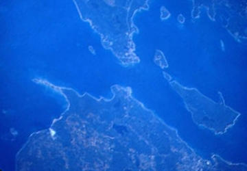
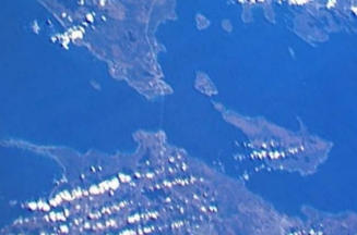
 In this photo,
Cheboygan, Michigan is visible in the lower, right corner. Bois Blanc Island
(locally called Bob-lo) is the largest island, just above Cheboygan. The
small Island between Bois Blanc and Mackinac Island is Round Island. Waugoshance
Point is to the west of Mackinaw City and is part of Wilderness State Park,
Michigan's largest state park. In this photo,
Cheboygan, Michigan is visible in the lower, right corner. Bois Blanc Island
(locally called Bob-lo) is the largest island, just above Cheboygan. The
small Island between Bois Blanc and Mackinac Island is Round Island. Waugoshance
Point is to the west of Mackinaw City and is part of Wilderness State Park,
Michigan's largest state park.
Photo takeen 8/11/89. Courtesy of NASA.
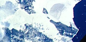
 This winter photo
shows an ice covered Straits of Mackinac with the Mackinac Bridge showing
as a faint line. The darker water to the east is new ice, with a tiny amount
of dark open water in the lower right corner. During the winter, snow mobiles
cross the ice between St. Ignace and Mackinac Island and between Cheboygan
and Bois Blanc. The United States Coast Guard Cutter Mackinac is stationed
in the Cheboygan River. Photo courtesy
of NASA. This winter photo
shows an ice covered Straits of Mackinac with the Mackinac Bridge showing
as a faint line. The darker water to the east is new ice, with a tiny amount
of dark open water in the lower right corner. During the winter, snow mobiles
cross the ice between St. Ignace and Mackinac Island and between Cheboygan
and Bois Blanc. The United States Coast Guard Cutter Mackinac is stationed
in the Cheboygan River. Photo courtesy
of NASA.
|

Mackinac Bridge

Seaplane Tour

Mackinaw Island

Winter in Mackinaw

Straits Lighthouses

Mackinac 2001
Live
Bridge Cam |
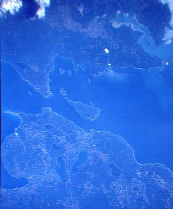
 This much larger shot
includes a portion of Little Traverse Bay, with Harbor Springs on its north
coast and Petosky on its south coast, in the lower left. The St. Mary's
River and Canada are visible upper right. Sault Ste Marie is in the upper
center. This much larger shot
includes a portion of Little Traverse Bay, with Harbor Springs on its north
coast and Petosky on its south coast, in the lower left. The St. Mary's
River and Canada are visible upper right. Sault Ste Marie is in the upper
center.
Carp Lake is visible, just south of Mackinac City. The smaller lake
beneath it is Douglas Lake. The two lakes running north-south in the lower
center are Burt Lake on the left and Mullet Lake on the right. The remaining
large lake, to their right, is Black Lake
Original photos courtesy of NASA. Photo versions shown on this page
and all text copyright 1997-2009 by Keith
Stokes.
These photos may not be reproduced without written permission.
My home
page
|
 This much larger shot
includes a portion of Little Traverse Bay, with Harbor Springs on its north
coast and Petosky on its south coast, in the lower left. The St. Mary's
River and Canada are visible upper right. Sault Ste Marie is in the upper
center.

 In this photo,
Cheboygan, Michigan is visible in the lower, right corner. Bois Blanc Island
(locally called Bob-lo) is the largest island, just above Cheboygan. The
small Island between Bois Blanc and Mackinac Island is Round Island. Waugoshance
Point is to the west of Mackinaw City and is part of Wilderness State Park,
Michigan's largest state park.
 This winter photo
shows an ice covered Straits of Mackinac with the Mackinac Bridge showing
as a faint line. The darker water to the east is new ice, with a tiny amount
of dark open water in the lower right corner. During the winter, snow mobiles
cross the ice between St. Ignace and Mackinac Island and between Cheboygan
and Bois Blanc. The United States Coast Guard Cutter Mackinac is stationed
in the Cheboygan River. Photo courtesy
of NASA.